Precipitation Map
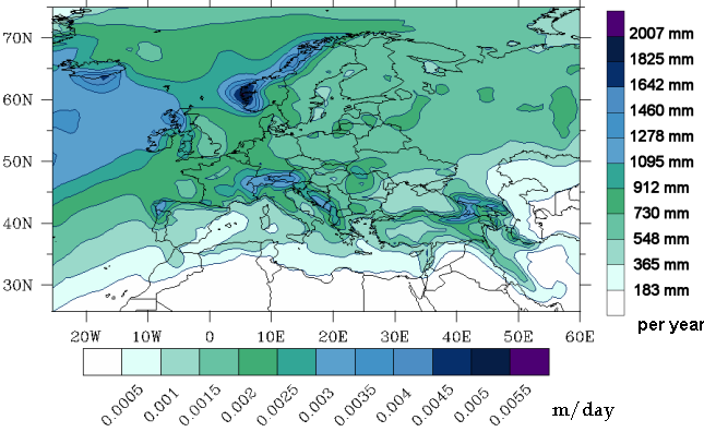
The average annual precipitation (rain, snowfall, etc.) from the ERA-Interim data (years 1990-2002). Three-hourly precipitation amounts from this data source are used in the calculations with the FLEXPART model. As wash-out is much more effective than dry deposition, precipitation has an important influence on the consequences of nuclear accidents.
The precipitation map shows some important features:
- Mountain regions have more precipitation and therefore also a higher risk for ground contamination.
- Most parts of the Mediterranean, especially the southern areas, have very low precipitation.
- Western Europe and especially the northwestern coasts have more precipitation than Eastern Europe.